By Spokesman Newsroom
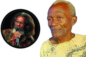
BASSETERRE, St. Kitts (Wednesday 3rd July 2024) – “I’m scared to even think about the true peak of the hurricane season…we never had a category 5 hurricane develop late June, early July in the Atlantic; never had one.” So said Senior Meteorological Officer of the St.
Kitts Met Office, Elmo Burke, in expressing his concerns about the upcoming peak of the hurricane season during a live appearance on Freedom FM’s ‘SKN Today’ aired on Tuesday 2nd July 2024, hosted by media personality Eboni Brandon. He touched on the intensity of Hurricane Beryl, a Category 5 storm that traversed the Caribbean unusually early in the season.
“This is the first time in history that we have ever had a category five storm traversing the Caribbean so early in the season,” he stated. Burke noted the rapid intensification of the storm, which transformed from a depression to a major hurricane in just 42 hours, emphasizing the unusually warm sea conditions attributed to climate change.
“What we’re seeing is what we would normally see happening in late AugustSeptember, and to see this moving from a depression to a category four major hurricane within 42 hours or so is insane, and it’s testament that the seas are so, so warm,” Burke explained. “We keep saying this because of climate change right now, the sea conditions are so, so warm, especially in the Atlantic, that it’s ripe for rapid intensification as long as the other conditions are favourable.” – LOCAL NEWS – Despite preparations by state agencies, he expressed concerns over community complacency.
“However, it’s sad to say I get the impression that there’s a level of complacency still within a lot of persons within the community,” he said. “Recognizing that we haven’t been hit with a hurricane or a storm in so long; it’s almost over 10 years since a storm really done any major damage to us here in St.
Kitts and Nevis.” Burke detailed the current meteorological conditions, explaining how the high-pressure system in the Atlantic is steering potential storms towards the island chain. “What we’re looking at in terms of the dominance of the highpressure system, the dominance of the high-pressure system in the Atlantic is steering whatever comes across the Atlantic straight to the island chain, so somebody is likely to be impacted,” he noted.
He also addressed another potential storm system that is forecasted to the third named storm of the season. “There is the system still there, however, because of some of the dust and because Beryl now would have turned up a lot of this warm water, it kind of would have soaked up some of that fuel so to speak, so the chances of it developing is relatively lower than what we anticipated at the start of the week.
However, at the same time, it’s still gonna bring some unsettled weather to almost the same set of islands.” When quizzed about the outlook for the peak of the hurricane season, the met officer had this to say: “I’m scared to even think about the true peak of the hurricane season; what’s expected to happen…because we’re in uncharted territory,” Burke admitted. “As I said earlier, we never had a category 5 hurricane develop late June, early July in the Atlantic; never had one.” Burke emphasized the importance of preparedness, citing Hurricane Beryl as a clear indication of the devastation that unprepared communities could face.
“We have to be prepared because Beryl is clearly an indication that if you’re not prepared adequately, it can be devastating,” he stressed. Front Page Photo: Heaped-up sand piles on the eastern end of the Bay Road in St. Kitts on Wednesday 3rd July 2024, due to the high surf in the Caribbean Sea caused by Hurricane Beryl. (Spokesman Snap) 3