By: Spokesman Newsroom
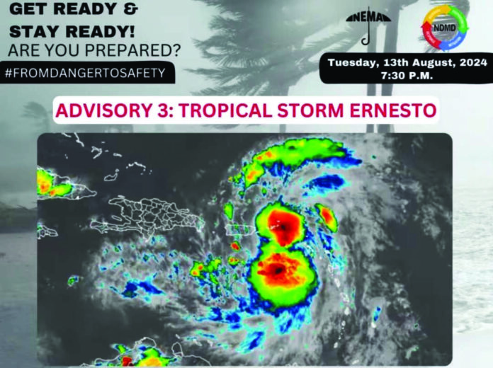
BASSETERRE, St. Kitts (Thursday, 15th August 2024) -Hours after leaving minimal damage in St. Kitts and Nevis following its passage on Tuesday 13th August 2024, Tropical Storm Ernesto intensified and was officially upgraded to a Category 1 hurricane the next day.
Of note, the storm warning was discontinued as of 8:00 PM on Tuesday as the all clear was announced by the National Emergency Management Agency (NEMA).
As of 5:00pm that day, the center of the storm was tracked at 104 miles northwest of the federation and was moving in a west north westerly position at about 18 miles per hour and had maximum sustained winds of 60 miles per hour. At that point the center continued to move away while it continued to strengthen with moderate to heavy showers.
The public was informed that conditions were expected to subside within hours as the storm continued to move away.
Reports from National Disaster Coordinator Abdias Samuel indicated that the storm caused minimal damage across the Federation.
The impact included downed trees, power lines, and significant damage to coastal areas due to high surf following the storm’s passage. There were also reports of some homes being damaged by fallen trees. As gathered, four individuals needing temporary housing were taken to hurricane shelter in St. Kitts.
During its closest approach, Tropical Storm Ernesto passed approximately 28 miles south of St. Kitts and Nevis, bringing tropical storm-force winds between 40 to 50 miles per hour.
The storm’s impact led to power outages and disruptions in water supply services, sparking a wave of public criticism on social media directed at the St. Kitts Electricity Company (SKELEC).
In response, Samuel on Thursday 15th August applauded the hardworking SKELEC crew whilst urging the public to exercise patience and understanding as work continues in fully restoring services.
As Ernesto moved away from the twin-island nation, it continued to strengthen, moving in a northwestward direction impacting islands including the US Virgin Islands.
By Wednesday, 14th August, the storm had developed into a hurricane, with maximum sustained winds reaching 75 miles per hour while tracked moving in a northern direction of Puerto Rico.
According to the weather forecast, hurricane force winds are expected to impact the island of Bermuda between 4-7pm on Saturday 17th August.
According to a report from a Bermuda news source Bernews.com, a hurricane warning was issued as of 6 p.m. on Thursday, 15th August as it continues on its path.
The forecast details for the island Bermuda are as follows:
• Tropical storm force winds (34+ knots) between 5-7pm Friday.
• Storm force winds (50+ knots) between 12-2am Saturday.
• Hurricane force winds (65+ knots) between 5-8am Saturday.
• The cessation of these impactful winds are as follows: Hurricane force winds (65+ knots) between 4-7pm Saturday. Storm force winds (50+ knots) between 8-11pm Saturday. Tropical storm force winds (34+ knots) between 5-7am Sunday
Additionally, the Bermuda Airport announced it would close at 8 p.m. on Friday, advising passengers to check with airlines for flight status updates.
